 Every ship
Guides
Language
EnglishCurrency
US dollar · $GetYourGuide shows prices in the currency you choose.
Guide · Margerie Glacier
Margerie Glacier on a Glacier Bay Alaska cruise, up close
Nearly every big ship in the park ends its course in front of one wall of ice at the head of Tarr Inlet. Here is what that glacier is, how it is changing, and what to watch for during the hour your ship waits in front of it.
Check availabilityfrom $2,047 · cancel without a fee
Editorial team, glacierbayalaskacruise.comUpdated October 17, 2026Reading time 6 min33 sources
In short
- 01Where
- At the northern end of Tarr Inlet, the furthest reach of the Glacier Bay waterway.1
- 02Size
- About 200 feet above the water, 0.85 miles wide and 21 miles long.2
- 03Speed
- The ice flows about 6 feet a day.3
- 04Your stop
- Ships stop in front of a tidewater glacier for about an hour.4
- 05Changing
- The park reports it is thinning and receding.5
The glacier at the end of the cruise route
Big ships in Glacier Bay follow a similar course. They enter the park from Icy Strait, sail up the West Arm and turn into Tarr Inlet to reach Margerie Glacier.6 The glacier lies at the furthest reach of the Glacier Bay waterway, at the northern end of that inlet.1 For most passengers, it is the glacier that defines the whole day.
It is a long way in. Margerie Glacier is about 55 nautical miles by water from Bartlett Cove, near the park entrance.7 The ships take the morning to get there, passing younger and younger land as they go. By the time the ice comes into view, the forest has given way to bare rock, gravel and the first green of plants that arrived only recently.
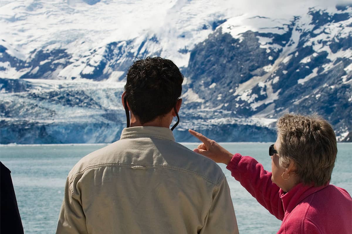
When the ship arrives, it stops. At some point in your day, the ship halts in front of a tidewater glacier for about an hour.4 On the standard cruise course that glacier is Margerie.6 The engines go quiet, the decks fill up, and the ice face that looked small on the horizon suddenly fills the whole view from bow to stern.
History
How the head of the bay came to look as it does
-
About 1750
The great retreat begins
A single glacier filled the bay and began to pull back.8
-
1879
John Muir names Grand Pacific
Its ice then reached much further south.9
-
1998
Margerie starts to recede
The northern third of its front pulls back.10
-
Recent years
Northern edge on land
Rangers note part of the front no longer reaches the sea.11
-
Each 1 September
Johns Hopkins Inlet opens
Cruise ships may enter, though few go to the face.12
How big Margerie Glacier is, and how fast it moves
The park's fact sheet gives Margerie Glacier a height of 200 feet above the water, a width of 0.85 miles and a length of 21 miles.2 It starts high in the Fairweather Range, at elevations above 9000 feet, and flows down to the sea.13 Mount Fairweather itself, the tallest mountain in the park, rises to 15,300 feet behind it.14
The glacier is not still. Its ice flows about 2000 feet a year, or about 6 feet a day.3 It rests on an underwater ledge rather than spreading out into the fjord, and the ice that arrives at the front breaks off into the sea. The ice you see at the face of the park's glaciers is estimated at about 200 years old.15
Those icebergs become part of the scene. The park notes that they serve as resting places for harbor seals, sea otters, black-legged kittiwakes and other birds.16 Bring binoculars: a floating berg that looks empty to the naked eye may hold a seal, and the white specks over the meltwater are often kittiwakes picking small fish from the surface.
Head of the bay
Three glaciers at the top of the West Arm
| Glacier | Size | State | From a cruise ship |
|---|---|---|---|
| Margerie | 21 miles long, 200 ft high | Thinning, receding | Up close, about an hour |
| Johns Hopkins | 16.4 miles long, 225-300 ft high | Thinning, advancing | From Jaw Point most of the summer |
| Grand Pacific | At the head of Tarr Inlet | No longer tidewater | Beside Margerie |
Compare
The two glaciers you hope to see
Every ship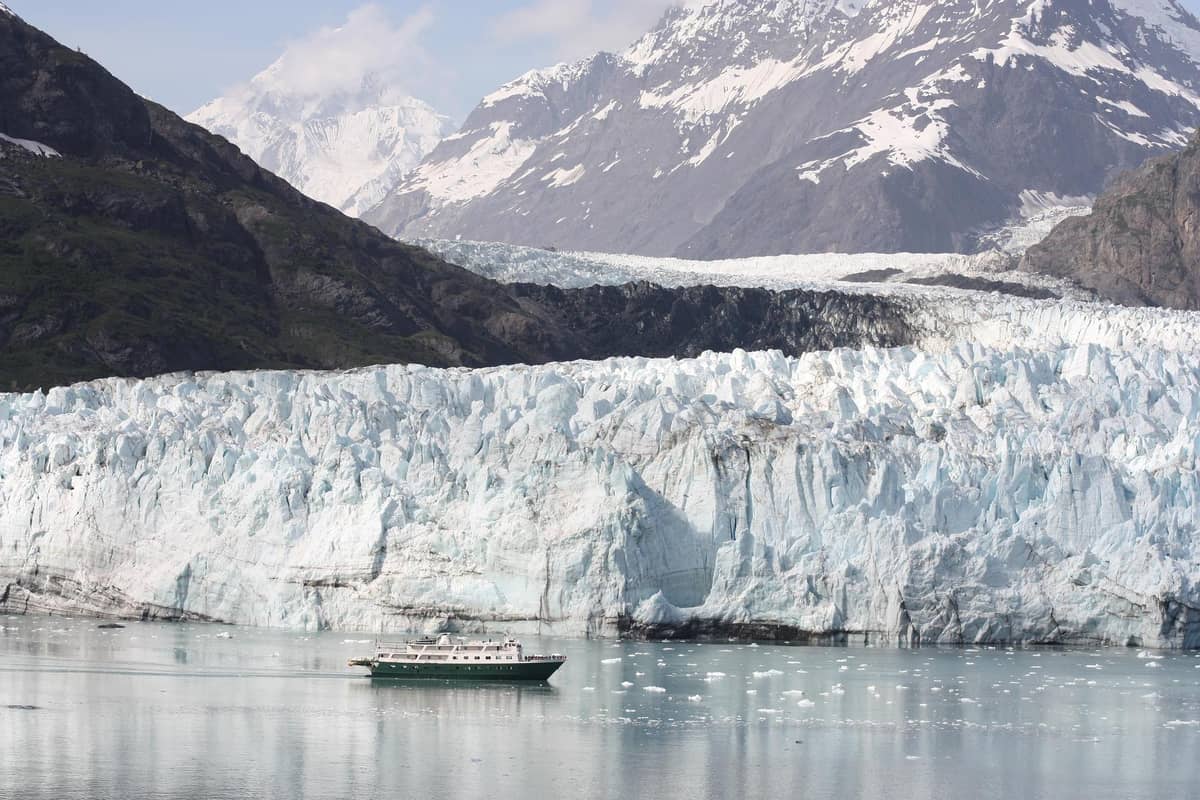 Late summer
Johns Hopkins Glacier
Johns Hopkins Inlet
- Length
- 16.4 miles
- Height
- 225-300 ft
- Inlet
- Opens 1 September
 Bookable
Decision helper
How to plan your glacier day
Pick what matters most to you
the ice of Margerie Glacier flows relatively quickly, estimated to flow about 2000 feet per year, or about 6 feet per day.
Watching for glacier calving on a Glacier Bay cruise
Everyone on deck hopes for the same thing: glacier calving on a Glacier Bay cruise, a block of ice breaking off the face and crashing into the sea. The park is clear that nobody can predict it. Calving happens in sun or rain, heat or cold, and sometimes not at all during a one-hour visit, sometimes several times within it.20
You hear it before you understand it. A crack like a rifle shot, a low rumble, then a pause before the ice actually falls. Watch the face rather than your camera screen, and keep your eyes on the areas with fresh blue ice, where pieces have recently broken away. When a large piece goes, a wave rolls out across the inlet and the floating ice rocks for minutes afterwards.
If your ship is lucky, the hour brings several falls; if not, the glacier is still worth the stop. Use the time to look at the details: the blue of dense ice, the dark bands of rock carried down the mountain, and the meltwater streams at the edges. Those details are what your photographs will show best, whether or not the ice falls.
Map
From Vancouver up the coast into Glacier Bay
The route of the 9-day trip along the coast, then a closer look at the bay itself, from Bartlett Cove up to the glaciers at its head.
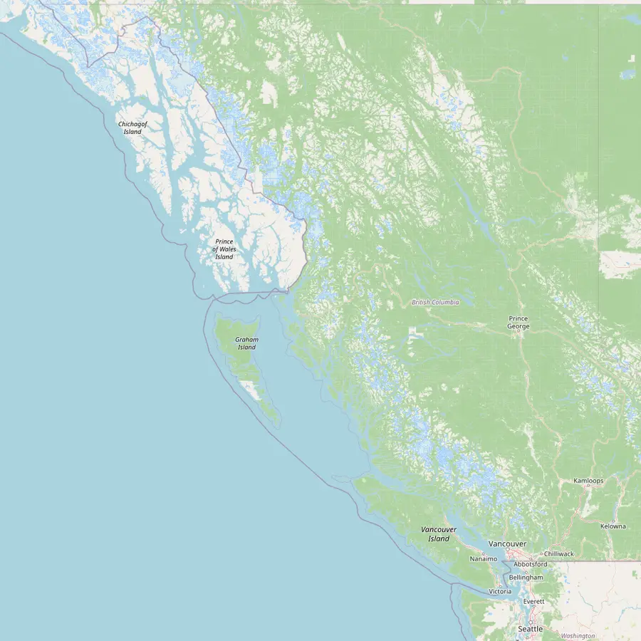 1Vancouver2Johnstone Strait3Ketchikan4Juneau5Glacier Bay
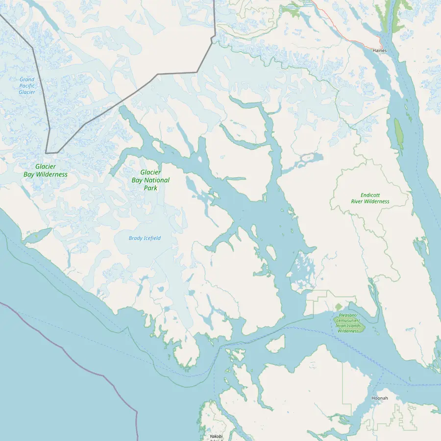 6Bartlett Cove7Gustavus8South Marble Island9Johns Hopkins Glacier10Margerie Glacier
- 1Vancouver
Where the 9-day trip begins and ends, with FlyOver Canada and Capilano Suspension Bridge Park before you board.
In Google Maps ↗ - 2Johnstone Strait
A channel on the sheltered Inside Passage, the waterway the listing's day 3 and day 8 are spent cruising; the listing does not name the exact channels.
In Google Maps ↗ - 3Ketchikan
The port of day 7 on the listing.
In Google Maps ↗ - 4Juneau
The port of day 5; Glacier Bay lies about 60 miles to the west.22
In Google Maps ↗ - 5Glacier Bay
Day 6 of the listing; no more than two cruise ships may enter in a day.23
In Google Maps ↗ - 6Bartlett Cove
Park headquarters and Glacier Bay Lodge, 10 miles by road from Gustavus; the daily tour boat leaves from here.2425
In Google Maps ↗ - 7Gustavus
The small town with the airport, about 65 miles northwest of Juneau.26
In Google Maps ↗ - 8South Marble Island
There may be over 300 sea lions on its rocks.27
In Google Maps ↗ - 9Johns Hopkins Glacier
Its inlet is closed to all vessels from May 1 to June 30, and most ships view it from 7 miles away.2819
In Google Maps ↗ - 10Margerie Glacier
About 21 miles long, at the northern end of Tarr Inlet.131
In Google Maps ↗
Checklist
Your hour in front of the glacier
01
Before you arrive
- Find the glacier time in the daily program
- Claim a spot at an outside rail
- Put on a hat, gloves and a warm layer
02
At the face
- Watch areas of fresh blue ice
- Listen for the crack before the fall
- Scan the icebergs for seals
Cost calculator
What reaching the glacier costs your group
See what your group pays at the starting price, trip by trip.
People
Total from$4,093
per participant from $2,047
Check availabilityfree cancellationTotals use each listing's lowest per-traveler price on GetYourGuide, turned into your currency with the euro reference rate; you see the exact sum when you book.
Video
Margerie Glacier Calving (Glacier Bay National Park Alaska) July 22, 2024 Royal Princess Cruise Ship
Nothing loads from YouTube until you tap play.
A glacier in retreat
Margerie Glacier is changing in front of the visitors who come to see it. In 1998 the northern third of its front began a noticeable recession, forming a small bay within the ice face.10 The park now reports that the glacier is both rapidly thinning and receding.5 Rangers traveling on cruise ships have noted that the northern part of the front now ends on land, no longer reaching salt water.11
Its neighbor shows where that path can lead. Grand Pacific Glacier, beside Margerie at the head of Tarr Inlet, has retreated over 250 years to the head of the inlet, and its front no longer reaches the sea.18 John Muir named it in 1879, when its ice reached much further south.9 Today its lower ice is covered in rock debris and looks more like a hillside than a glacier.
The wider park tells the same story. There is 11 percent less glacial ice in Glacier Bay than in the 1950s.29 For a visitor, that is a reason to go rather than a reason to stay away: the glacier is still a towering tidewater face today, and the rangers on board will explain what you are looking at and how it has changed.
Johns Hopkins Glacier on a cruise
Around the corner from Tarr Inlet lies the park's other famous glacier. The National Park Service calls Johns Hopkins perhaps the most scenic of its tidewater glaciers.30 Its face stands 225 to 300 feet above the water, about a mile wide, and the glacier is 16.4 miles long, thinning but advancing.17 It is about 63 nautical miles from Bartlett Cove.7
Seeing Johns Hopkins Glacier on a cruise is a matter of timing. The inlet in front of it holds the largest seasonal gathering of harbor seals in Glacier Bay, typically over 2,000 of them.31 It is closed to all vessels from May 1 to June 30 each year.28 For most of the summer, ships turn around at Jaw Point at the mouth of the inlet, and passengers see the glacier from 7 miles away.19
Late in the season the rules relax. Johns Hopkins Inlet opens to cruise ships on 1 September, but only a small number of them travel all the way to the face of the glacier.12 Treat a close view as a bonus. From Jaw Point the glacier still fills the end of its valley, framed by peaks, and binoculars bring the seals on the ice into view.
Making the most of your hour at the ice
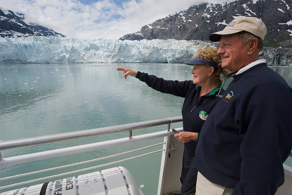
Know when the ship will be at the glacier. Your daily program and the park map left in your stateroom the evening before will help you plan.32 The park says the best side of the ship is outside, especially near the glaciers.33 Get out early, find a spot at the rail and stay put.
Dress for cold air coming off the ice. Even on a summer day, the wind across the inlet bites, and you will stand still for a long time. Wear a hat, gloves and a waterproof layer. Keep your camera ready, but give your eyes a few minutes without it too: the sound of the glacier, the cracks and the rumbles, is worth taking in as well.
The trip this site books brings you here on day 6 of a 9-day package from Vancouver. It starts from $2,047, it is new and has no reviews yet, and the listing leaves the ship and cabin to the booking. If you are already in Southeast Alaska, the day boat from Bartlett Cove visits up to four tidewater glaciers and waits at least half an hour at one.21
Plan the voyage
Nine days from Vancouver into Glacier Bay
Book today, pay nearer the time, and cancel at no charge until 24 hours ahead.
You ask,we answer.
How tall is Margerie Glacier?
About 200 feet above the water. The park's fact sheet also gives a width of 0.85 miles and a length of 21 miles.2
How long do ships stay at the glacier?
About an hour. Ships stop in front of a tidewater glacier for approximately one hour.4
Will I see the glacier calve?
Maybe. Calving sometimes does not happen in a one-hour visit and sometimes happens several times.20
Is Margerie Glacier shrinking?
Yes. The park reports it is rapidly thinning and receding.5
Can I see Johns Hopkins Glacier from the ship?
Usually from Jaw Point. For most of the summer ships see it from 7 miles away.19
How fast does the ice move?
About 6 feet a day. That is about 2000 feet a year.3
Which day of this site's cruise reaches the glacier?
Day 6. The 9-day trip lists Glacier Bay National Park on day 6.
Sources
Sources and evidence
- 1National Park ServiceMargerie Glacier↩
- 2National Park Service (Glacier Bay)Glacier Bay Fact Sheet↩
- 3National Park ServiceMargerie Glacier↩
- 4National Park Service (Glacier Bay)Cruise Ships in Glacier Bay↩
- 5National Park ServiceGlacier Changes Drive New Challenges for Balancing Visitor Access and Natural Resource Protection↩
- 6National Park ServiceGlacier Changes Drive New Challenges for Balancing Visitor Access and Natural Resource Protection↩
- 7National Park Service (Glacier Bay)Frequently Asked Questions↩
- 8National Park Service (Glacier Bay)Glacier Bay Fact Sheet↩
- 9National Park ServiceGrand Pacific Glacier↩
- 10National Park ServiceMargerie Glacier↩
- 11National Park ServiceGlacier Changes Drive New Challenges for Balancing Visitor Access and Natural Resource Protection↩
- 12National Park ServiceGlacier Changes Drive New Challenges for Balancing Visitor Access and Natural Resource Protection↩
- 13National Park ServiceMargerie Glacier↩
- 14National Park Service (Glacier Bay)Glacier Bay Fact Sheet↩
- 15National Park Service (Glacier Bay)Glaciers↩
- 16National Park ServiceMargerie Glacier↩
- 17National Park Service (Glacier Bay)Glacier Bay Fact Sheet↩
- 18National Park ServiceGrand Pacific Glacier↩
- 19National Park ServiceGlacier Changes Drive New Challenges for Balancing Visitor Access and Natural Resource Protection↩
- 20National Park Service (Glacier Bay)Frequently Asked Questions↩
- 21National Park Service (Glacier Bay)Glacier Bay Tour Boat↩
- 22National Park Service (Glacier Bay)Glacier Bay Issues Prospectus for Cruise Ship Services (news release, 2018)↩
- 23National Park Service (Glacier Bay)Concession Contracts↩
- 24National Park Service (Glacier Bay)Basic Information↩
- 25National Park Service (Glacier Bay)Glacier Bay by Boat↩
- 26National Park Service (Glacier Bay)Basic Information↩
- 27National Park Service (Glacier Bay)Glacier Bay Tour Boat↩
- 28National Park ServiceHarbor Seal - Johns Hopkins Inlet↩
- 29National Park Service (Glacier Bay)Glaciers↩
- 30National Park Service (Glacier Bay)Frequently Asked Questions↩
- 31National Park ServiceGlacier Changes Drive New Challenges for Balancing Visitor Access and Natural Resource Protection↩
- 32National Park Service (Glacier Bay)Cruise Ships in Glacier Bay↩
- 33National Park Service (Glacier Bay)Cruise Ships in Glacier Bay↩
Keep reading